The Trinidad Flood May 18-20, 1955
…The Reason the Weather Net Was Started
On May 17, 1955, a cold front moved into southeastern Colorado, bringing heavy rain over a belt up to 150 miles wide, extending into the Sangre de Cristo Range, and into southwestern Kansas and northeastern New Mexico.
The heaviest rains fell late on May 18 and the early part of May 19. The largest rainfall total was at Lake Maloya, in New Mexico, south of Trinidad and near the headwaters of the Purgatoire River, where 13.5 inches of rain fell.
The resulting flood caused extensive property damage, the most severe along the main stem of the Arkansas River between Pueblo and John Martin Reservoir, and the most severe flooding at Rocky Ford, La Junta and Las Animas, and along the Purgatoire from Weston to Alfalfa.
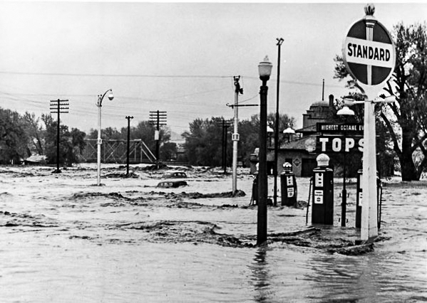
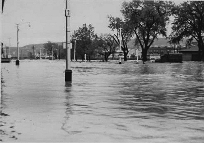
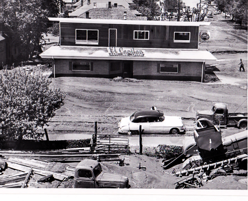
Major flooding was especially severe at Trinidad “where the flood was practically of a flash nature”. 2800 people were evacuated from their homes, and two people lost their lives. Damages included inundated farmland, damaged crops, drowned cattle, damaged railroads and highways, flooded businesses and houses, dozens of irrigation ditch and bridge washouts. Several railroads and highways were severly damaged, and telephone facilities were washed out over a wide area.
Several hams were on hand providing emergency communications and during many conversations between the amateur radio personnel and onsite Weather Service staff, the idea of a volunteer weather reporting network was discussed and ultimately resulted in the creation of the Colorado Amateur Radio Weather Net. Our first official net was held at 0630 on September 21, 1955. And we haven’t missed a day since!
Ron Seats, KØLZD of Rosita was, in high school in Trinidad at the time, and an avid amateur photographer. These pictures were taken and developed by Ron during the flood., and signed on the back “Photograph by Ronnie Seats Trinidad, Colorado”